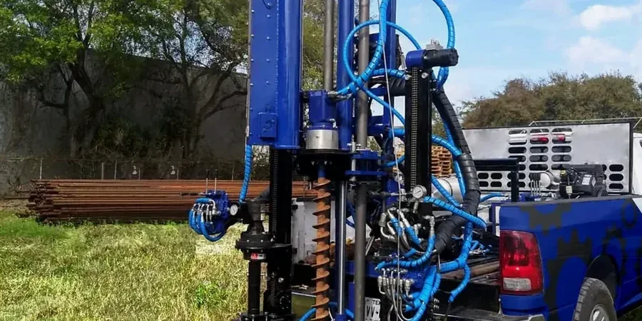
Warrington's subsurface is dominated by glacial till overlying Sherwood Sandstone, with pockets of alluvial silts and peat along the Mersey floodplain. These transitions, often within a single site, demand accurate in-situ strength profiling before any foundation decision is made. The Standard Penetration Test remains the most practical tool for logging these variations, providing N-values that feed directly into bearing capacity calculations under Eurocode 7. From the Omega Business Park expansion to residential plots near Birchwood, every SPT log we review tells a story about compaction history, water table influence, and potential weak zones. When boreholes encounter the sand lenses common in the till, we often combine SPT data with grain size analysis to confirm drainage behaviour and filter compatibility—critical for retaining wall design where groundwater is perched within the drift.
An SPT N-value from the glacial till at 6 m depth in Warrington typically overpredicts strength by 15-20% if energy ratio corrections are not applied—a detail that separates compliant reports from approximate ones.
Our approach and scope
At just 8 metres above sea level near the Mersey and rising to 75 metres towards Appleton, Warrington's topography reflects a post-glacial landscape where ground conditions can shift from dense boulder clay to soft fluvial deposits within 20 metres of borehole advance. The SPT, conducted in accordance with BS 5930:2015, uses a 63.5 kg hammer falling 760 mm to drive a split-spoon sampler 450 mm into the ground, with blow counts recorded for each 75 mm increment. The sum of the second and third increments defines the N-value, which we correct for overburden pressure and energy ratio using the 60% reference standard. In the stiff tills of south Warrington, N-values typically range from 15 to 35, indicating competent bearing strata, while the alluvial silts near Latchford rarely exceed N=8 and require ground improvement consideration. Each test depth is logged with material description, moisture state, and consistency classification per BS EN ISO 14688-2, building a defensible factual report that the design team can rely on.
Common questions
What depth of SPT investigation is typical for a two-storey residential project in Warrington?
For a two-storey dwelling we generally advance SPT boreholes to between 6 m and 10 m below ground level, depending on the anticipated foundation type and the thickness of the superficial deposits. In the Warrington area, where glacial till often overlies sandstone at depths of 5 m to 12 m, we aim to penetrate at least 2 m into competent bearing strata. The borehole depth is confirmed during the investigation based on real-time N-value trends and material recovery.
How much does an SPT investigation cost for a standard residential plot in Warrington?
For a typical residential plot requiring two SPT boreholes to 8 m depth, with factual reporting and site attendance, the cost ranges from £410 to £600. The final figure depends on access conditions, the number of boreholes needed, and whether laboratory testing of recovered samples is included. This range covers the rig mobilisation, the SPT execution per BS EN ISO 22476-3, and the delivery of a factual report.
How do you handle groundwater observations during SPT work in Warrington?
Each SPT borehole is used to install a standpipe or piezometer after completion, allowing groundwater level monitoring over at least 24 hours, and typically over several days. In Warrington's alluvial corridors, where perched water within sand lenses is common, we record water strikes during drilling and measure stabilised levels at multiple visits. This data is reported alongside the SPT log, enabling the designer to assess effective stress conditions and dewatering requirements for excavations.