← Home · Geophysics

Electrical Resistivity Testing (VES) in Warrington

Together, we solve the challenges of tomorrow.

LEARN MORE →

Assuming uniform ground conditions across a Warrington site is a costly mistake. Glacial till and river terrace deposits shift abruptly here. You can’t see the transition from sand to clay from the surface. A contractor last year hit an unmapped paleochannel near the Mersey floodplain. The dewatering costs tripled the earthworks budget. Vertical electrical sounding eliminates that risk. We inject a controlled DC current and measure the apparent resistivity at depth. Changes in resistivity reveal the real stratigraphy before the first excavator arrives. We combine this data with intrusive CPT testing when clients need both geophysical coverage and mechanical parameters for foundation design under Eurocode 7.

A VES survey maps the invisible — saline groundwater plumes, clay lenses, and buried channels — before a single borehole is drilled.

Our approach and scope

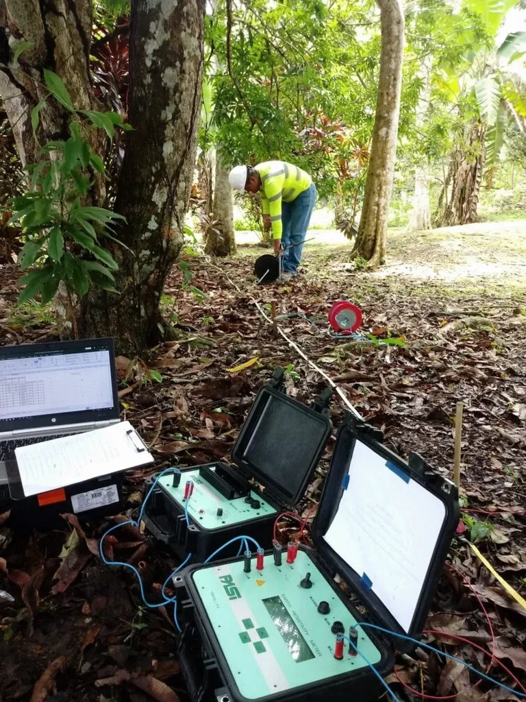
Warrington’s expansion from a Roman ford settlement to an industrial canal town has left a complex buried landscape. Old mill foundations, backfilled marl pits, and rerouted watercourses hide beneath modern business parks. Electrical resistivity surveys detect these anomalies without disturbing the ground. The VES method uses a Schlumberger array with expanding electrode spacing. Apparent resistivity curves are inverted to produce a 1D layered model of true resistivity versus depth. We run quality checks at each sounding point. Contact resistance is verified. Reciprocal measurements catch field errors. For linear infrastructure, we complement the survey with MASW profiling to add shear wave velocity data and improve the geotechnical model for pavement design per BS 5930.
Electrical Resistivity Testing (VES) in Warrington
Technical reference image — Warrington

Site-specific factors

The Sherwood Sandstone aquifer under Warrington is a major regional water resource. Its depth varies considerably. In the north, it outcrops near Winwick. South of the ship canal, it dives beneath thick sequences of glacial till and clay. Misjudging overburden thickness means casing collapses during drilling or artesian conditions during piling. A VES survey maps the clay/sandstone interface accurately. Another risk is saline intrusion along the Mersey estuary corridor. Low resistivity anomalies indicate brackish groundwater that attacks concrete. Ignoring this leads to sulfate attack on foundations. We correlate resistivity signatures with water chemistry samples to specify the correct Design Sulfate Class per BRE Special Digest 1. The alternative is discovering the problem years later through spalling concrete.

Need a geotechnical assessment?

Reply within 24h.

Email: info@geotechnical-engineering.biz

Video overview

Technical parameters

ParameterTypical value
MethodSchlumberger array vertical electrical sounding (VES)
Max investigation depth100–150 m (dependent on AB/2 spread)
Measured parameterApparent resistivity (Ω·m) vs electrode spacing
Output1D resistivity model (true resistivity vs depth)
Data quality controlContact resistance check, reciprocal error <5%
Applicable standardBS 5930:2015 + A1:2020
Typical array length200–400 m for 50–80 m penetration

Related services

01

1D Vertical Electrical Sounding

We deploy a Schlumberger array with current electrode spacings from 2 m to 400 m. The resulting resistivity-depth profiles identify lithological boundaries, estimate depth to bedrock, and delineate saturated zones. Each sounding includes field notes on electrode placement and local topography for accurate inversion.

02

Resistivity Imaging for Linear Infrastructure

For pipeline routes and road corridors crossing the Mersey floodplain, we combine multiple VES soundings with 2D ERT profiles. This maps lateral changes in clay thickness and detects buried peat horizons that cause differential settlement under flexible pavement design.

Reference standards

BS 5930:2015 + A1:2020 — Code of practice for ground investigations, Eurocode 7 (BS EN 1997-1:2004) — Geotechnical design, BRE Special Digest 1 — Concrete in aggressive ground

Common questions

What does a VES survey cost for a typical site in Warrington?

A standard VES campaign with 4–6 sounding points in the Warrington area ranges from £480 to £950, depending on access conditions, maximum depth required, and number of array expansions. We provide a fixed-price quote after reviewing the site plan and project objectives.

How deep can the resistivity method investigate?

The investigation depth depends on the maximum current electrode spacing (AB). With an AB/2 of 200 m, we typically reach 50–70 m depth in Warrington’s glacial deposits. Greater depths are achievable with longer spreads, provided there is sufficient open space for cable layout.

Can VES distinguish between sand and clay layers?

Yes. Clean sands and gravels show higher resistivity (often above 100 Ω·m). Silts and clays exhibit low resistivity (below 30 Ω·m). The contrast is clear in the inverted models. We calibrate the geophysical interpretation with at least one borehole log to confirm the lithological boundary depths.

Is the survey affected by buried utilities or urban noise?

Urban environments present challenges. Buried metallic pipes and cables create conductive noise. We request utility plans before mobilisation and offset the array from known services. High-voltage power lines can induce telluric noise. We use stacking and filtering during acquisition to improve signal quality in Warrington’s industrial estates.
Location and service area

We serve projects in Warrington and surrounding areas.

View larger map